Home > Europe > France > Maps
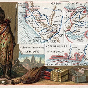
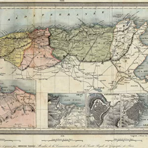
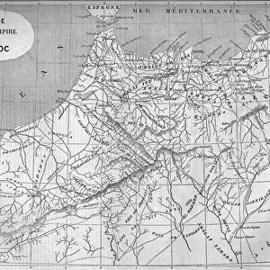
Panorama of French Africa, map of French expeditions in Africa

![]()
Wall Art and Photo Gifts from Fine Art Finder
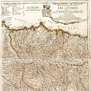
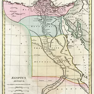
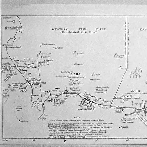
Panorama of French Africa, map of French expeditions in Africa
LSE4323866 Panorama of French Africa, map of French expeditions in Africa. Engraving in " Le petit journal" 5/03/1894. Selvas collection. by Unknown Artist, (19th century); Private Collection; (add.info.: Panorama of French Africa, map of French expeditions in Africa. Engraving in " Le petit journal" 5/03/1894. Selvas collection.); Photo eLeonard de Selva; out of copyright
Media ID 22746978
© Leonard de Selva / Bridgeman Images
FEATURES IN THESE COLLECTIONS
> Africa
> Related Images
> Arts
> Artists
> Related Images
> Fine Art Finder
> Artists
> Unknown Artist
> Maps and Charts
> Related Images
EDITORS COMMENTS
This print showcases a panoramic view of French Africa, depicting a detailed map of the various expeditions conducted by the French in the 19th century. The engraving was originally published in "Le petit journal" on March 5th, 1894 and is now part of the esteemed Selvas collection. The intricate details of this historical artifact provide valuable insights into the geographical landscape and colonial presence in Africa during that time. It serves as a testament to France's ambitious explorations and their significant impact on shaping African history. The artist behind this masterpiece remains unknown, yet their skillful craftsmanship is evident in every stroke. Leonard de Selva has expertly captured this image through his lens, immortalizing it for future generations to appreciate. As we gaze upon this remarkable print, we are transported back to an era where exploration and discovery were at their peak. The fusion of artistry and cartography allows us to delve deeper into the complexities of French colonialism while simultaneously appreciating the beauty found within these uncharted territories. This photograph offers a glimpse into our shared past, reminding us of both triumphs and challenges faced by those who sought to expand their influence across continents. It stands as a testament to human curiosity and ambition while also serving as a visual reminder of our responsibility towards preserving history for generations yet unborn.
MADE IN THE USA
Safe Shipping with 30 Day Money Back Guarantee
FREE PERSONALISATION*
We are proud to offer a range of customisation features including Personalised Captions, Color Filters and Picture Zoom Tools
SECURE PAYMENTS
We happily accept a wide range of payment options so you can pay for the things you need in the way that is most convenient for you
* Options may vary by product and licensing agreement. Zoomed Pictures can be adjusted in the Cart.