Home > Europe > Italy > Maps
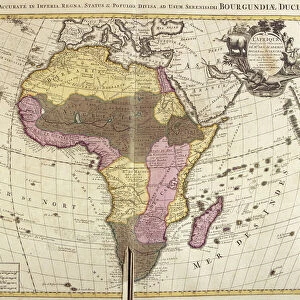
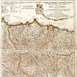
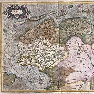
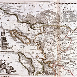
Map of Savoy and Piedmont (Italy) (Engraving, 1717)
 (Engraving, 1717)")
![]()
Wall Art and Photo Gifts from Fine Art Finder
Map of Savoy and Piedmont (Italy) (Engraving, 1717)
LRI4712872 Map of Savoy and Piedmont (Italy) (Engraving, 1717) by Nolin, Jean-Baptiste (c.1657-1708); Private Collection; (add.info.: Map of the states of Savoy and Piemont (Italy) - Engraving from the atlas le theatre du monde, 1717, by Jean Baptiste Nolin (1686-1762) - Map of Savoy and Piedmont (Italy) - From " Le Theatre du Monde" 1717 by Jean-Baptiste Nolin); Luisa Ricciarini; French, out of copyright
Media ID 22464374
© Luisa Ricciarini / Bridgeman Images
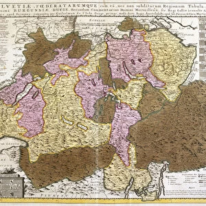
Atlas Book Piemont Savoy 73 Geographical Map
FEATURES IN THESE COLLECTIONS
> Europe
> Italy
> Piedmont
> Related Images
> Fine Art Finder
> Artists
> Jean-Baptiste Nolin
> Maps and Charts
> Italy
> Maps and Charts
> Related Images
EDITORS COMMENTS
This engraving, titled "Map of Savoy and Piedmont (Italy) (Engraving, 1717)" by Jean-Baptiste Nolin, takes us on a journey through the states of Savoy and Piemont in Italy. With intricate details and precise craftsmanship, this map offers a glimpse into the geographical landscape of the region during the 18th century. Nolin's work is part of his renowned atlas "Le Theatre du Monde" published in 1717. The map showcases his expertise as a cartographer, capturing every contour and boundary with remarkable accuracy. It serves as both an informative tool for navigation and an exquisite piece of art. The rich history embedded within this print transports us to a time when these territories were under French influence. As we explore each corner of Savoy and Piedmont, we can imagine the bustling cities, picturesque landscapes, and vibrant cultures that once thrived here. Luisa Ricciarini has skillfully preserved this historical gem from her private collection. By sharing it with us through Fine Art Finder, she allows us to appreciate not only its artistic beauty but also its significance in understanding the past. Whether you are an avid historian or simply captivated by old-world charm, this enchanting engraving will undoubtedly leave you mesmerized. Let yourself be transported back in time as you immerse yourself in the intricacies of "Map of Savoy and Piedmont (Italy) (Engraving, 1717). "
MADE IN THE USA
Safe Shipping with 30 Day Money Back Guarantee
FREE PERSONALISATION*
We are proud to offer a range of customisation features including Personalised Captions, Color Filters and Picture Zoom Tools
SECURE PAYMENTS
We happily accept a wide range of payment options so you can pay for the things you need in the way that is most convenient for you
* Options may vary by product and licensing agreement. Zoomed Pictures can be adjusted in the Cart.