Home > Europe > United Kingdom > England > London > Museums > National Maritime Museum
Map of the southwest of Africa, 18th century, 1754 (coloured engraving)
")
![]()
Wall Art and Photo Gifts from Fine Art Finder
Map of the southwest of Africa, 18th century, 1754 (coloured engraving)
7339407 Map of the southwest of Africa, 18th century, 1754 (coloured engraving) by French School, (18th century); 95x66 cm; National Maritime Museum, London, UK; (add.info.: Creator: Departement de la Marine
Reduced map of part of the west and south coasts of Africa. Border graduated for latitude & longitude. Meridians of Paris, Tenerife & Isle de Fer. Rhumb lines. Scale in French and English marine leagues.); © National Maritime Museum, Greenwich, London
Media ID 38509916
© © National Maritime Museum, Greenwich, London / Bridgeman Images
FEATURES IN THESE COLLECTIONS
> Africa
> South Africa
> Maps
> Africa
> South Africa
> Related Images
> Europe
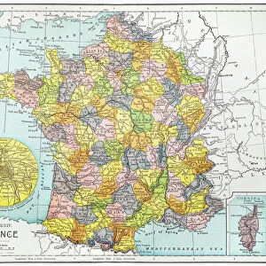
> France
> Paris
> Maps
> Europe
> United Kingdom
> England
> London
> Boroughs
> Greenwich
> Europe
> United Kingdom
> England
> London
> Museums
> Greenwich Heritage Centre
> Europe
> United Kingdom
> England
> London
> Museums
> National Maritime Museum
> Europe
> United Kingdom
> England
> London
> Towns
> Greenwich
> Europe
> United Kingdom
> Heritage Sites
> Maritime Greenwich
> Europe
> United Kingdom
> Maps
> Fine Art Finder
> Artists
> American School
> Fine Art Finder
> Artists
> French School
EDITORS COMMENTS
This stunning 18th-century coloured engraving of a map of the southwest of Africa offers a glimpse into the cartographic knowledge and artistic skill of the time. Created by the French School, this intricate piece measures 95x66 cm and is housed in the National Maritime Museum in London, UK.
The map showcases part of the west and south coasts of Africa, with borders graduated for latitude and longitude. Meridians of Paris, Tenerife, and Isle de Fer are marked, along with rhumb lines to aid navigation. The scale is provided in both French and English marine leagues.
Through this detailed representation, viewers can appreciate not only the geographical features of Africa but also the precision and artistry involved in creating such maps during this period. The vibrant colours used add an extra layer of visual appeal to this historical document.
This print serves as a reminder of our enduring fascination with exploring new lands and understanding our world's geography. It captures a moment in history when cartographers were pushing boundaries both literally and figuratively, expanding our knowledge through their meticulous craftsmanship.
MADE IN THE USA
Safe Shipping with 30 Day Money Back Guarantee
FREE PERSONALISATION*
We are proud to offer a range of customisation features including Personalised Captions, Color Filters and Picture Zoom Tools
SECURE PAYMENTS
We happily accept a wide range of payment options so you can pay for the things you need in the way that is most convenient for you
* Options may vary by product and licensing agreement. Zoomed Pictures can be adjusted in the Cart.