Home > Asia > Iran > Lakes > Caspian Sea
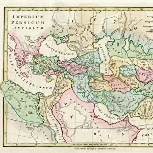
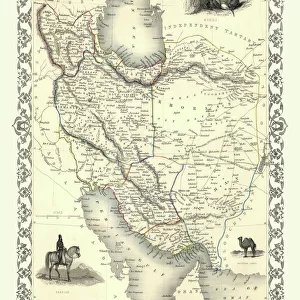
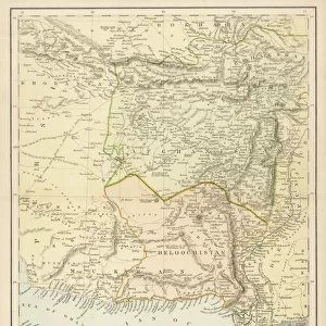
Antique map of Persia and Arabia 1730

![]()
Wall Art and Photo Gifts from Fine Art Storehouse
Antique map of Persia and Arabia 1730
Original antique copper engraved map by H. Moll, titled Persia Sive Shahistana, published in 1747 for the Universal History (London, T. Osborne & J. Shipton, 8 vols. 1747). This volume contains the history of the Persians with this fold out map
Unleash your creativity and transform your space into a visual masterpiece!
BernardAllum
Media ID 15311442
© Bernard Allum
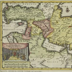
Afghanistan Arabia Babil Backgrounds Caspian Sea Conflict Cyprus Document Hand Colored India Iran Iraq Israel Jewish Ethnicity Judaism Land Mesopotamian Middle East Middle Eastern Ethnicity National Border Nations Paper People Traveling Persian Gulf Politics Region Residential District State Syria Topography Turkey Antique Map Vintage Map
FEATURES IN THESE COLLECTIONS
> Arts
> Artists
> S
> Syrian Syrian
> Arts
> Landscape paintings
> Waterfall and river artworks
> River artworks
> Asia
> Afghanistan
> Maps
> Asia
> Afghanistan
> Related Images
> Asia
> Cyprus
> Related Images
> Asia
> India
> Lakes
> Related Images
> Asia
> India
> Related Images
> Asia
> Iran
> Lakes
> Caspian Sea
> Asia
> Iran
> Lakes
> Related Images
> Fine Art Storehouse
> Map
> Historical Maps
EDITORS COMMENTS
This print showcases an exquisite antique map of Persia and Arabia from the year 1730. Created by the talented cartographer H. Moll, this original copper engraved map titled "Persia Sive Shahistana" was published in 1747 for the renowned Universal History. The volume containing this historical gem delves into the rich history of Persians, accompanied by a fascinating fold-out map. With its intricate details and hand-colored touches, this vintage map offers a glimpse into the past, revealing national borders, ancient cities, and significant landmarks across the Middle East. From Israel to Cyprus, Syria to Iran, Babil to Arabia - it encompasses a vast region that stretches as far as India and includes prominent features like the Caspian Sea and Mesopotamian lands. The visual representation not only serves as a valuable document but also provides insights into physical geography and topography. As one explores each etched line on this aged paper relic, they can immerse themselves in centuries-old politics, conflicts between nations, rivers connecting towns and people traveling along roads. This remarkable piece transports us back in time when these territories were shaped differently than today's maps depict them. It is truly an extraordinary artifact that captures both historical significance and artistic beauty – perfect for any enthusiast or collector interested in unraveling the mysteries of ancient civilizations within this mesmerizing part of Asia.
MADE IN THE USA
Safe Shipping with 30 Day Money Back Guarantee
FREE PERSONALISATION*
We are proud to offer a range of customisation features including Personalised Captions, Color Filters and Picture Zoom Tools
SECURE PAYMENTS
We happily accept a wide range of payment options so you can pay for the things you need in the way that is most convenient for you
* Options may vary by product and licensing agreement. Zoomed Pictures can be adjusted in the Cart.