Home > Europe > United Kingdom > England > London > Towns > Paddington
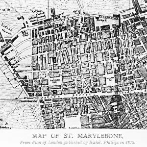
Map of the St Marylebone area, London

![]()
Wall Art and Photo Gifts from Mary Evans Picture Library
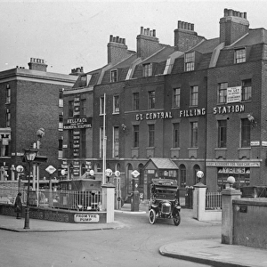
Map of the St Marylebone area, London
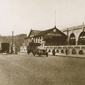
Map of the St Marylebone area, London. Date: circa 1900
Mary Evans Picture Library makes available wonderful images created for people to enjoy over the centuries
Media ID 14262928
© Mary Evans / Pharcide
Area Burial Cemetery Edgware Hyde Maps Marylebone Paddington Squares Stations Tyburn
FEATURES IN THESE COLLECTIONS
> Arts
> Portraits
> Pop art gallery
> Street art portraits
> Europe
> United Kingdom
> England
> London
> Related Images
> Europe
> United Kingdom
> England
> London
> Sights
> Hyde Park
> Europe
> United Kingdom
> England
> London
> Towns
> The Hyde
> Europe
> United Kingdom
> England
> London
> Towns
> Marylebone
> Europe
> United Kingdom
> England
> London
> Towns
> Paddington
> Europe
> United Kingdom
> England
> Maps
> Europe
> United Kingdom
> England
> Posters
> Europe
> United Kingdom
> England
> Related Images
> Maps and Charts
> Related Images
EDITORS COMMENTS
Step back in time with this map print of the St Marylebone area in London, circa 1900. This intricately detailed map transports us back to the Victorian and Edwardian eras, showcasing the intricate network of streets and roads that crisscrossed this historic district. The map reveals the heart of St Marylebone, with its bustling commercial areas around Oxford Street and Regent Street, as well as the tranquil squares and gardens, including the renowned Regent's Park and Hyde Park. The map also highlights the various stations of the Metropolitan and District Railways, including Paddington and Edgware Road, which were essential hubs of transportation during this period. One cannot discuss St Marylebone without mentioning its rich history. The map reveals the location of Tyburn Convent and Cemetery, a significant part of the area's past. Tyburn, also known as the "Gibbet Field," was once the site of public executions and a burial ground. The area's name derives from the Old English word "typing," meaning a gallows. As we explore this map, we are transported back to an era of horse-drawn carriages, grand Victorian houses, and the bustling energy of London's streets. A must-have for history enthusiasts, this map print is a beautiful addition to any home or office, providing a glimpse into the past and a reminder of the rich history that lies within the heart of London.
MADE IN THE USA
Safe Shipping with 30 Day Money Back Guarantee
FREE PERSONALISATION*
We are proud to offer a range of customisation features including Personalised Captions, Color Filters and Picture Zoom Tools
SECURE PAYMENTS
We happily accept a wide range of payment options so you can pay for the things you need in the way that is most convenient for you
* Options may vary by product and licensing agreement. Zoomed Pictures can be adjusted in the Cart.