Home > Europe > United Kingdom > Scotland > Highlands > Wick
Vale of White Horse OX12 0 Map

![]()
Wall Art and Photo Gifts from Map Marketing
Vale of White Horse OX12 0 Map
Postcode Sector Map of Vale of White Horse OX12 0
Media ID 19977297
Anderson Place Ashdown Way Barn Close Barnfield Berry Lane Blenheim Gardens Bramley Close Bridle Path Brook Lane Brookside Buckland Road Carlton Close Chapel Lane Church Street Colne Close Cotton Close Cow Lane Crown Close Crown Meadow Douglas Drive Downsview Road Elderberry Close Fairfield Close Halls Lane Hunters Close Hyde Road Kennet Close Limetree Close Longworth Road Main Street Mallard Way Massey Road Monks Close New Road Newlands Drive North Green Old Mill Close Orchard Close Peregrine Way Princess Gardens School Lane School Road Shepherds Close St James Way Stevenson Close Steventon Road Swan Close Teal Close The Causeway The Croft The Firs The Green The Maples The Meads The Paddocks Vale Of White Horse Walnut Court Wellington Street Westbrook Westfield Close Whitley Close Windrush Close Windsor Street Woodgate Close
FEATURES IN THESE COLLECTIONS
> Animals
> Birds
> Waterfowl
> Ducks
> Mallard
> Animals
> Farm
> Cattle
> Related Images
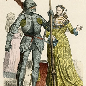
> Arts
> Artists
> D
> Alfred
> Related Images
> Arts
> Artists
> E
> Alfred East
> Europe
> United Kingdom
> Scotland
> Highlands
> Wick
> Map Marketing
> Postcode Sector Maps
> OX - Oxford
> Maps and Charts
> Related Images
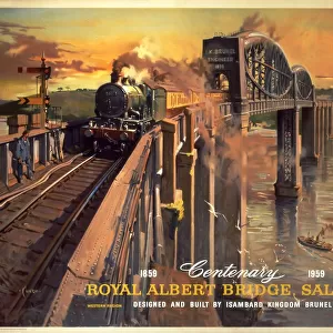
> Popular Themes
> Brunel
MADE IN THE USA
Safe Shipping with 30 Day Money Back Guarantee
FREE PERSONALISATION*
We are proud to offer a range of customisation features including Personalised Captions, Color Filters and Picture Zoom Tools
SECURE PAYMENTS
We happily accept a wide range of payment options so you can pay for the things you need in the way that is most convenient for you
* Options may vary by product and licensing agreement. Zoomed Pictures can be adjusted in the Cart.