Home > Animals > Mammals > Pteropodidae > Occidentalis
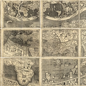
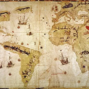
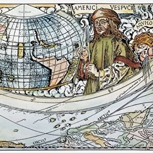
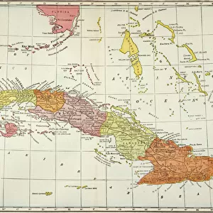
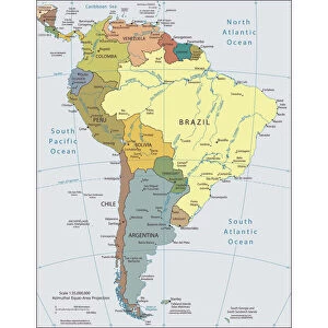
Early map of the New World, 1513

![]()
Wall Art and Photo Gifts from North Wind
Early map of the New World, 1513
Tabula Terre Nove 1513: the Admirals Map of the Caribbean and Terra Incognita (unknown lands).
Hand-colored woodcut reproduction
North Wind Picture Archives brings history to life with stock images and hand-colored illustrations
Media ID 5880377
© North Wind Picture Archives
1500s 16th Century Age Of Discovery America Caribbean Caribbean Sea Cartography Cuba Discover Discovery Document Exploration Explore Explorer Florida Gulf Of Mexico Hispaniola Mexico Navigation New World South America South American West Indies 1513 Caribbean Islands Isabella
FEATURES IN THESE COLLECTIONS
> Animals
> Mammals
> Phyllostomidae
> Occidentalis
> Animals
> Mammals
> Pteropodidae
> Occidentalis
> Animals
> Mammals
> Vespertilionidae
> Isabella
> Maps and Charts
> Early Maps
> Maps and Charts
> World
> North America
> Cuba
> Maps
> North America
> Cuba
> Related Images
> North America
> Mexico
> Related Images
> North America
> Related Images
> North Wind Picture Archives
> Exploration
> North Wind Picture Archives
> Maps
EDITORS COMMENTS
This print takes us back in time to the early 16th century, offering a glimpse into the fascinating world of exploration and cartography. The "Early map of the New World, 1513" is a hand-colored woodcut reproduction that showcases the Admirals Map of the Caribbean and Terra Incognita. As we gaze upon this vintage piece, we are transported to an era when brave explorers set sail across unknown seas in search of new lands. The map depicts various regions such as Florida, Mexico, South America, and the West Indies with intricate detail. The vibrant colors bring life to this historic document, allowing us to appreciate its artistic value alongside its historical significance. It serves as a testament to the age of discovery and highlights how early navigators charted their course through uncharted territories. From Hispaniola to Isabella and Cuba, every corner of this map holds secrets waiting to be unraveled by intrepid adventurers. The Gulf of Mexico and Caribbean Sea dominate the landscape while numerous islands dotting these waters add further intrigue. This remarkable piece invites us on a journey through time as we explore not only North America but also South America's coastlines during an era when much was still terra incognita – unknown land awaiting discovery. Let it serve as a reminder of our rich heritage and ignite our curiosity about those who paved the way for future generations' exploration endeavors.
MADE IN THE USA
Safe Shipping with 30 Day Money Back Guarantee
FREE PERSONALISATION*
We are proud to offer a range of customisation features including Personalised Captions, Color Filters and Picture Zoom Tools
SECURE PAYMENTS
We happily accept a wide range of payment options so you can pay for the things you need in the way that is most convenient for you
* Options may vary by product and licensing agreement. Zoomed Pictures can be adjusted in the Cart.