Home > Europe > United Kingdom > England > Dorset > Grove
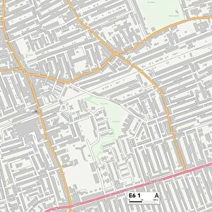
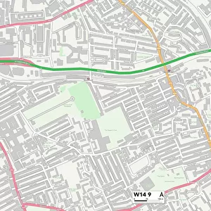
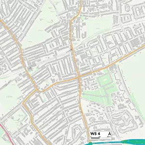
Ealing W5 4 Map

![]()
Wall Art and Photo Gifts from Map Marketing
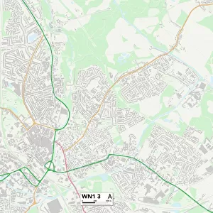
Ealing W5 4 Map
Postcode Sector Map of Ealing W5 4
Media ID 19980968
Airedale Road Almond Avenue Ash Grove Aspen Close Beech Gardens Birkbeck Road Blossom Close Bramley Road Carlyle Road Cedar Grove Cherry Close Chestnut Grove Church Gardens Church Place Clovelly Road Coningsby Road Darwin Road Derwent Road Devonshire Road Dorset Road Durham Road Ealing Gloucester Road Hawthorn Gardens Hereford Road Hollies Road Junction Road Lawrence Road Lilac Gardens Maple Grove Murray Road North Road Northfields Occupation Lane Olive Road Overdale Road Palm Grove Popes Lane Redwood Grove Rose Gardens Rowan Close South Road St Marys Square Sunderland Road Sycamore Avenue Temple Road Trent Avenue Wellington Road Weymouth Avenue Willow Road Windmill Road York Road
FEATURES IN THESE COLLECTIONS
> Europe
> United Kingdom
> England
> Dorset
> Grove
> Europe
> United Kingdom
> England
> Dorset
> Netherbury
> Europe
> United Kingdom
> England
> Dorset
> Related Images
> Europe
> United Kingdom
> England
> Dorset
> Trent
> Europe
> United Kingdom
> England
> Dorset
> Weymouth
> Europe
> United Kingdom
> England
> Durham
> Chilton
> Europe
> United Kingdom
> England
> Durham
> Durham
> Europe
> United Kingdom
> England
> Durham
> Hawthorn
> Europe
> United Kingdom
> England
> Durham
> Sunderland
> Europe
> United Kingdom
> England
> Herefordshire
> Maps
> Map Marketing
> Postcode Sector Maps
> W - London W
MADE IN THE USA
Safe Shipping with 30 Day Money Back Guarantee
FREE PERSONALISATION*
We are proud to offer a range of customisation features including Personalised Captions, Color Filters and Picture Zoom Tools
SECURE PAYMENTS
We happily accept a wide range of payment options so you can pay for the things you need in the way that is most convenient for you
* Options may vary by product and licensing agreement. Zoomed Pictures can be adjusted in the Cart.