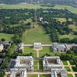
Home > Europe > United Kingdom > England > London > Museums > National Maritime Museum
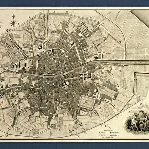
Plan of Lucknow, plotted from a survey made in 1856, by Lieut. Moorsom, 52nd. Lt. Infantry. (Presented by Captain Moorsom, C.E.), c.1856 (silk, paper)
, c.1856 (silk, paper)")
![]()
Wall Art and Photo Gifts from Fine Art Finder
Plan of Lucknow, plotted from a survey made in 1856, by Lieut. Moorsom, 52nd. Lt. Infantry. (Presented by Captain Moorsom, C.E.), c.1856 (silk, paper)
7339413 Plan of Lucknow, plotted from a survey made in 1856, by Lieut. Moorsom, 52nd. Lt. Infantry. (Presented by Captain Moorsom, C.E.), c.1856 (silk, paper) by British School, (19th century); 94x67 cm; National Maritime Museum, London, UK; (add.info.: Creator: Moorsom; War Department
Single sheet. Col. lith. Medium: Top and bottom edges bound in green silk. Scale: [ca. 1:6 000]. Cartographic Note: Ungraduated map. Scale in yards.); © National Maritime Museum, Greenwich, London
Media ID 38509918
© © National Maritime Museum, Greenwich, London / Bridgeman Images
FEATURES IN THESE COLLECTIONS
> Animals
> Insects
> Hemiptera
> Green Scale
> Arts
> Artists
> I
> Indian School Indian School
> Asia
> India
> Related Images
> Europe
> United Kingdom
> England
> London
> Boroughs
> Greenwich
> Europe
> United Kingdom
> England
> London
> Museums
> British Museum
> Europe
> United Kingdom
> England
> London
> Museums
> Greenwich Heritage Centre
> Europe
> United Kingdom
> England
> London
> Museums
> National Maritime Museum
> Europe
> United Kingdom
> England
> London
> Sights
> British Museum
> Fine Art Finder
> Artists
> British School
> Fine Art Finder
> Artists
> French School
EDITORS COMMENTS
This intricate and detailed print showcases the Plan of Lucknow, meticulously plotted from a survey conducted in 1856 by Lieut. Moorsom of the 52nd Lt. Infantry. Presented by Captain Moorsom, C.E., this historical artifact provides a glimpse into the layout and structure of Lucknow during the mid-19th century.
Measuring at 94x67 cm, this map is a testament to the cartographic skills of its creators. The top and bottom edges are elegantly bound in green silk, adding a touch of sophistication to this piece. The scale of approximately 1:6,000 allows viewers to appreciate the fine details captured within its borders.
The ungraduated map features scale measurements in yards, providing valuable information about distances and proportions within Lucknow. The vibrant colors used in this print bring life to the streets, buildings, and landmarks depicted on it.
As we gaze upon this work of art from the National Maritime Museum in London, we are transported back in time to an era when cartography was both a science and an art form. This Plan of Lucknow serves as a reminder of our rich history and heritage, encapsulating a moment frozen in time for generations to come.
MADE IN THE USA
Safe Shipping with 30 Day Money Back Guarantee
FREE PERSONALISATION*
We are proud to offer a range of customisation features including Personalised Captions, Color Filters and Picture Zoom Tools
SECURE PAYMENTS
We happily accept a wide range of payment options so you can pay for the things you need in the way that is most convenient for you
* Options may vary by product and licensing agreement. Zoomed Pictures can be adjusted in the Cart.