Home > Aerial Photography > Related Images
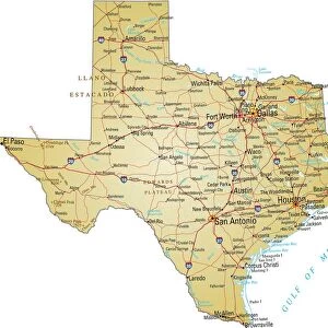
Irving Texas US City Street Map

![]()
Wall Art and Photo Gifts from Fine Art Storehouse
Irving Texas US City Street Map
Vector Illustration of a City Street Map of Irving, Texas, USA. Scale 1:60, 000.
All source data is in the public domain.
U.S. Geological Survey, US Topo
Used Layers:
USGS The National Map: National Hydrography Dataset (NHD)
USGS The National Map: National Transportation Dataset (NTD)
Unleash your creativity and transform your space into a visual masterpiece!
Frank Ramspott
Media ID 15192958
© Frank Ramspott, all rights reserved
Aerial View City Map Computer Graphic Directly Above Downtown District Gray Road Map Texas Text Digitally Generated Image Green Color Irving White Color
FEATURES IN THESE COLLECTIONS
> Aerial Photography
> Related Images
> Animals
> Insects
> Hemiptera
> Green Scale
> Arts
> Contemporary art
> Digital artwork
> Street art
> Arts
> Landscape paintings
> Waterfall and river artworks
> River artworks
> Arts
> Portraits
> Pop art gallery
> Street art portraits
> Arts
> Street art graffiti
> Digital art
> Digital paintings
> Arts
> Street art graffiti
> Digital art
> Vector illustrations
> Fine Art Storehouse
> Map
> Street Maps
> Fine Art Storehouse
> Map
> USA Maps
> Maps and Charts
> Geological Map
> Maps and Charts
> Related Images
> North America
> United States of America
> Lakes
> Related Images
EDITORS COMMENTS
This print showcases a meticulously detailed vector illustration of the vibrant city street map of Irving, Texas, USA. With a scale of 1:60,000, this artwork offers an immersive experience that allows viewers to explore every nook and cranny of this bustling city. The source data used in creating this masterpiece is all in the public domain, courtesy of U. S. Geological Survey's National Hydrography Dataset (NHD) and National Transportation Dataset (NTD). The image captures the essence of Irving's downtown district with its intricate network of roads leading to various destinations within the city. A serene lake and river add natural beauty to the urban landscape while highlighting Irving's unique geography. Rendered in vivid colors such as gray, blue, white, and green, this digitally generated image provides a visually stunning aerial view from directly above. The inclusion of text enhances navigability within the map while maintaining a sleek design aesthetic. Created by talented artist Frank Ramspott for Fine Art Storehouse, this print is perfect for those who appreciate cartography and want to admire Irving's charm from afar. It serves as both an informative tool and a captivating piece of art suitable for any space or decor style
MADE IN THE USA
Safe Shipping with 30 Day Money Back Guarantee
FREE PERSONALISATION*
We are proud to offer a range of customisation features including Personalised Captions, Color Filters and Picture Zoom Tools
SECURE PAYMENTS
We happily accept a wide range of payment options so you can pay for the things you need in the way that is most convenient for you
* Options may vary by product and licensing agreement. Zoomed Pictures can be adjusted in the Cart.