Home > Arts > Photorealistic artworks > Detailed art pieces > Masterful detailing in art
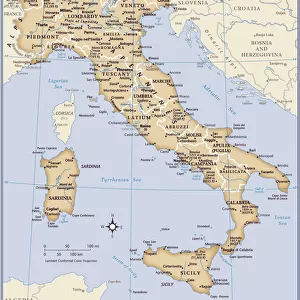
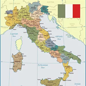
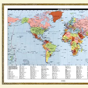
Italy Map - illustration

Wall Art and Photo Gifts from Fine Art Storehouse
Italy Map - illustration
Colored Map of Italy The urls of the reference files are (country, continent, world map and globe).
http://www.lib.utexas.edu/maps/europe/italy_admin_06.jpg http://www.lib.utexas.edu/maps/world_maps/time_zones_ref_2011.pdf - The illustration was completed January 09, 2016 and created in Corel Draw - 1 layer of data used for the detailed outline of the land
Unleash your creativity and transform your space into a visual masterpiece!
Media ID 14777517
FEATURES IN THESE COLLECTIONS
> Arts
> Photorealistic artworks
> Detailed art pieces
> Masterful detailing in art
> Europe
> France
> Canton
> Landes
> Europe
> Italy
> Related Images
> Fine Art Storehouse
> Map
> Italian Maps
> Fine Art Storehouse
> Map
> Map Illustrations
> Fine Art Storehouse
> Top Sellers - Art Prints
> Maps and Charts
> Italy
> Maps and Charts
> Popular Maps
> Maps and Charts
> Related Images
> Maps and Charts
> World
EDITORS COMMENTS
This vibrant and detailed print of the Italy Map is a captivating illustration that showcases the beauty and diversity of this enchanting country. Created in Corel Draw, this artwork was meticulously crafted with one layer of data to ensure accuracy in outlining the land. The colors used in this map bring it to life, making it an eye-catching addition to any space. From the stunning coastline along the Mediterranean Sea to the majestic peaks of the Italian Alps, every region is clearly depicted, allowing you to explore and appreciate Italy's rich geography. Whether you are planning a trip or simply have a love for cartography, this print serves as both an informative tool and a beautiful piece of art. Hang it on your wall or display it on your desk; its intricate details will surely spark conversations about Italy's history, culture, and landmarks. With references from reliable sources such as world maps and globes, you can trust that this illustration accurately represents Italy's administrative divisions within Europe. Its completion date in January 2016 ensures that it reflects up-to-date information about cities, towns, provinces, and regions across the country. Add a touch of elegance and sophistication to your home or office with this colored map of Italy - an artistic masterpiece that celebrates one of Europe's most beloved destinations.
MADE IN THE USA
Safe Shipping with 30 Day Money Back Guarantee
FREE PERSONALISATION*
We are proud to offer a range of customisation features including Personalised Captions, Color Filters and Picture Zoom Tools
SECURE PAYMENTS
We happily accept a wide range of payment options so you can pay for the things you need in the way that is most convenient for you
* Options may vary by product and licensing agreement. Zoomed Pictures can be adjusted in the Cart.