Home > Europe > France > Canton > Charente
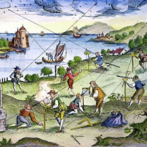
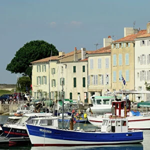
La Rochelle. Map of the city on the Atlantic. 16th century

![]()
Wall Art and Photo Gifts from Mary Evans Picture Library
La Rochelle. Map of the city on the Atlantic. 16th century
La Rochelle. Map of the city on the Atlantic. Sixteenth-century engraving by Jollain
Mary Evans Picture Library makes available wonderful images created for people to enjoy over the centuries
Media ID 14319264
© Thaliastock / Mary Evans
Atlantic Cartography Department Harbor Mapping Plan Rochelle Charente Maritime Jollain
FEATURES IN THESE COLLECTIONS
> Animals
> Mammals
> Muridae
> Western Mouse
> Arts
> Artists
> O
> Oceanic Oceanic
> Europe
> France
> Canton
> Charente
> Maps and Charts
> Early Maps
> Maps and Charts
> Related Images
> Transportation
> Ships and Boats
MADE IN THE USA
Safe Shipping with 30 Day Money Back Guarantee
FREE PERSONALISATION*
We are proud to offer a range of customisation features including Personalised Captions, Color Filters and Picture Zoom Tools
SECURE PAYMENTS
We happily accept a wide range of payment options so you can pay for the things you need in the way that is most convenient for you
* Options may vary by product and licensing agreement. Zoomed Pictures can be adjusted in the Cart.