Home > Europe > United Kingdom > England > London > Boroughs > Hillingdon
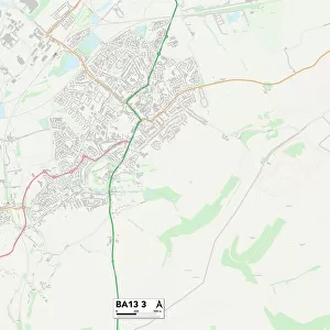
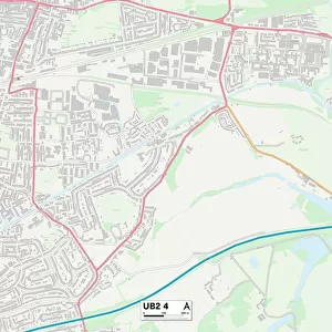
Hillingdon UB3 2 Map

![]()
Wall Art and Photo Gifts from Map Marketing
Hillingdon UB3 2 Map
Postcode Sector Map of Hillingdon UB3 2
Media ID 19979928
Albion Road Almond Close Appleby Close Bishops Road Bramley Close Cedar Avenue Central Avenue Chamberlain Close Church Green Church Road Church Walk Churchfield Close College Way Compton Road Cranmer Road Cromwell Road Damson Drive East Avenue East Way Eighth Avenue Elm Close Evergreen Way Fifth Avenue First Avenue Fourth Avenue Freemans Lane Glebe Road Grange Close Grange Road Greenfield Place Hawthorn Place Hillingdon Kingsway Lilac Gardens Longmead Road Manor Road Manton Close Maxwell Close Monarch Drive Ninth Avenue North Avenue North Road Orchard Road Parsonage Close Poplar Place Queens Road Rectory Road Reid Close Rowan Place Second Avenue Seventh Avenue Sixth Avenue St Marys Crescent St Marys Road St Marys Walk Stuart Crescent Sycamore Avenue Third Avenue Townfield Road Trinity Drive Tudor Road Victoria Close Wesley Road West Avenue Wood End York Avenue Commonwealth Avenue Hayes
FEATURES IN THESE COLLECTIONS
> Animals
> Insects
> Beetle
> Fireflies
> Animals
> Mammals
> Muridae
> Heath Mouse
> Europe
> United Kingdom
> England
> London
> Boroughs
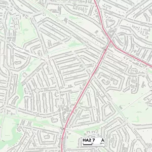
> Harrow
> Europe
> United Kingdom
> England
> London
> Boroughs
> Hillingdon
> Europe
> United Kingdom
> Scotland
> Fife
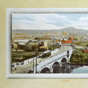
> Leven
> Europe
> United Kingdom
> Scotland
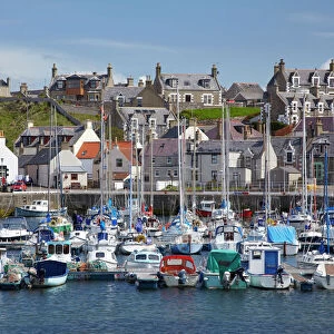
> Moray
> Related Images
> Map Marketing
> Postcode Sector Maps
> UB - Uxbridge
> Maps and Charts
> Related Images
MADE IN THE USA
Safe Shipping with 30 Day Money Back Guarantee
FREE PERSONALISATION*
We are proud to offer a range of customisation features including Personalised Captions, Color Filters and Picture Zoom Tools
SECURE PAYMENTS
We happily accept a wide range of payment options so you can pay for the things you need in the way that is most convenient for you
* Options may vary by product and licensing agreement. Zoomed Pictures can be adjusted in the Cart.