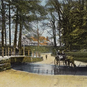
Home > Europe > United Kingdom > England > London > Sights > Victoria Park
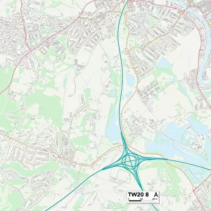
Runnymede TW20 0 Map

![]()
Wall Art and Photo Gifts from Map Marketing
Runnymede TW20 0 Map
Postcode Sector Map of Runnymede TW20 0
Media ID 19982240
Albert Road Alder Close Alexandra Road Almond Close Armstrong Road Ashwood Road Bagshot Road Bond Street Castle Hill Road Cherrywood Avenue Chestnut Close Chestnut Drive Clarence Drive Englefield Close Fircroft Road Ham Lane Hanover Close Harvest Road Hazel Close Highfield Court Highfield Road Holly Close Ilex Close Kings Lane Kingsley Avenue Kingswood Close Laburnum Place Lancaster Close Laurel Avenue Linden Court Lodge Close Maple Court Middle Hill Oak Lane Oak Tree Drive Parsonage Road Pine Way Prospect Lane Runnymede South Road Southcroft Spencer Gardens St Cuthberts Close St Judes Close Swallowfield Sycamore Walk The Green The Retreat Victoria Street Wick Lane Wick Road Willow Walk Bishopsgate Falaise
FEATURES IN THESE COLLECTIONS
> Animals
> Mammals
> Muridae
> Ilex
> Arts
> Artists
> H
> John Hillers
> Arts
> Artists
> H
> John Hills
> Arts
> Artists
> L
> John Lodge
> Arts
> Artists
> P
> John Pine
> Arts
> Artists
> W
> John Wood
> Europe
> United Kingdom
> England
> London
> Sights
> Victoria Park
> Europe
> United Kingdom
> Scotland
> Highlands
> Wick
> Map Marketing
> Postcode Sector Maps
> TW - Twickenham
> Maps and Charts
> Related Images
MADE IN THE USA
Safe Shipping with 30 Day Money Back Guarantee
FREE PERSONALISATION*
We are proud to offer a range of customisation features including Personalised Captions, Color Filters and Picture Zoom Tools
SECURE PAYMENTS
We happily accept a wide range of payment options so you can pay for the things you need in the way that is most convenient for you
* Options may vary by product and licensing agreement. Zoomed Pictures can be adjusted in the Cart.