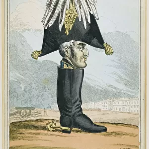
Home > Europe > United Kingdom > England > London > Politics > Arthur Wellesley
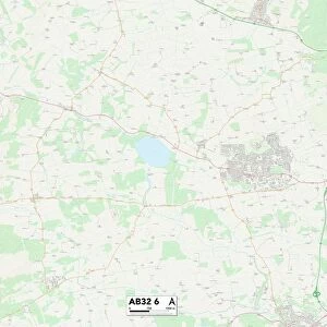
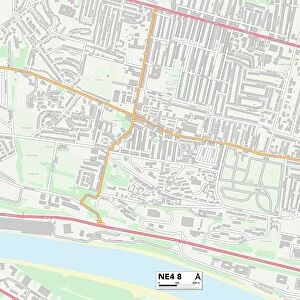
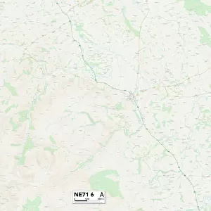
Newcastle NE4 5 Map

![]()
Wall Art and Photo Gifts from Map Marketing
Newcastle NE4 5 Map
Postcode Sector Map of Newcastle NE4 5
Media ID 19974510
Beaconsfield Street Bishops Avenue Brighton Grove Buckingham Street Cookson Close Corporation Street Croydon Road Derby Street Douglas Terrace Edward Place Hamilton Crescent Holywell Close Lancaster Street Mansfield Place Mansfield Street New Mills Newcastle Philip Street Pitt Street Spring Street Stanhope Street Stanton Street Tamworth Road Thorpe Close Wellington Street
FEATURES IN THESE COLLECTIONS
> Europe
> United Kingdom
> England
> London
> Boroughs
> Croydon
> Europe
> United Kingdom
> England
> London
> Politics
> Arthur Wellesley
> Europe
> United Kingdom
> Northern Ireland
> County Down
> Newcastle
> Europe
> United Kingdom
> Scotland
> Strathclyde
> Hamilton
> Map Marketing
> Postcode Sector Maps
> NE - Newcastle upon Tyne
> Maps and Charts
> Related Images
MADE IN THE USA
Safe Shipping with 30 Day Money Back Guarantee
FREE PERSONALISATION*
We are proud to offer a range of customisation features including Personalised Captions, Color Filters and Picture Zoom Tools
SECURE PAYMENTS
We happily accept a wide range of payment options so you can pay for the things you need in the way that is most convenient for you
* Options may vary by product and licensing agreement. Zoomed Pictures can be adjusted in the Cart.