Home > Arts > Artists > C > Edward Clay
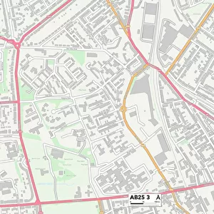
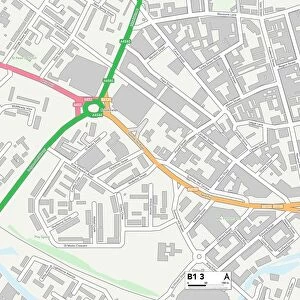
Birmingham B26 1 Map

![]()
Wall Art and Photo Gifts from Map Marketing
Birmingham B26 1 Map
Postcode Sector Map of Birmingham B26 1
Media ID 19965363
Arden Drive Barrows Lane Birmingham Bosworth Road Brindle Close Cambridge Way Clay Lane Coventry Road Croft Road Gladstone Road Harvey Road Lime Grove Manor House Lane Martin Close Moat Lane Ollerton Road Orchard Rise Paddock Drive Preston Road Rutland Drive Wensley Road Yew Tree Avenue Yew Tree Lane
FEATURES IN THESE COLLECTIONS
> Arts
> Artists
> C
> Edward Clay
> Arts
> Artists
> G
> Charles Green
> Arts
> Artists
> M
> Charles Martin
> Europe
> United Kingdom
> England
> Birmingham
> Area
> Lyndon Green
> Europe
> United Kingdom
> England
> Rutland
> Barrow
> Europe
> United Kingdom
> England
> Rutland
> Preston
> Europe
> United Kingdom
> England
> Rutland
> Related Images
> Map Marketing
> Postcode Sector Maps
> B - Birmingham
> Maps and Charts
> Related Images
MADE IN THE USA
Safe Shipping with 30 Day Money Back Guarantee
FREE PERSONALISATION*
We are proud to offer a range of customisation features including Personalised Captions, Color Filters and Picture Zoom Tools
SECURE PAYMENTS
We happily accept a wide range of payment options so you can pay for the things you need in the way that is most convenient for you
* Options may vary by product and licensing agreement. Zoomed Pictures can be adjusted in the Cart.