Home > Arts > Artists > R > Roman Roman
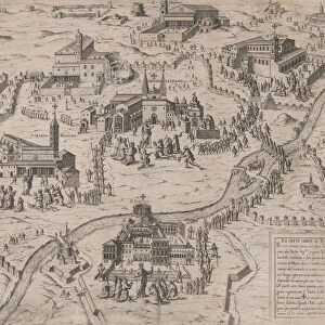
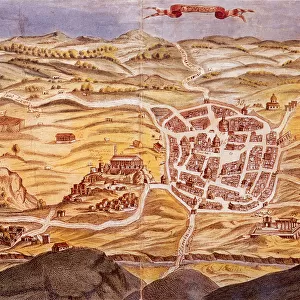
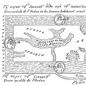
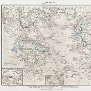
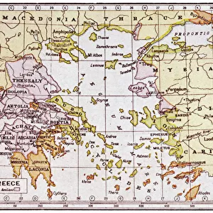
Speculum Romanae Magnificentiae: Map of Greece, mid-16th century. mid-16th century

![]()
Wall Art and Photo Gifts from Heritage Images
Speculum Romanae Magnificentiae: Map of Greece, mid-16th century. mid-16th century
Speculum Romanae Magnificentiae: Map of Greece, mid-16th century
Heritage Images features heritage image collections
Media ID 20288139
© Heritage Art/Heritage Images
Adriatic Aegean Sea Athens Coastline Constantinople Crete Island Islands Latin Mirror Of The Magnificence Of Rome Speculum Romanae Magnificentiae The Mirror Of Roman Magnificence Turkey Turkish Reggio Sebastiano Di Re
FEATURES IN THESE COLLECTIONS
> Arts
> Artists
> R
> Roman Roman
> Asia
> Turkey
> Related Images
> Europe
> Greece
> Related Images
> Europe
> Italy
> Lazio
> Rome
> Europe
> Italy
> Related Images
EDITORS COMMENTS
This print captures the "Speculum Romanae Magnificentiae: Map of Greece" from the mid-16th century. Created by Sebastiano di Re, an Italian artist, this map showcases the ancient geography of Greece during that time period. The intricate details and precision in this engraving highlight the coastal beauty of Greece, with its numerous islands scattered across the Aegean Sea. From Athens to Constantinople, every city is meticulously labeled, allowing viewers to immerse themselves in the rich history of this region. The mountains towering over the landscape add depth and dimension to this map, emphasizing both its geographical features and historical significance. Crete stands out as a prominent island in this depiction, showcasing its importance within ancient Greek culture. As part of the "Speculum Romanae Magnificentiae" which translates to "Mirror of Roman Magnificence" this map serves as a testament to Rome's influence on Greek civilization. It offers a glimpse into how Romans perceived and celebrated their own cultural heritage through art. Preserved at The Metropolitan Museum of Art (the Met), this print represents an invaluable piece of our collective heritage. Its publication allows us to appreciate not only Sebastiano di Re's artistic talent but also his dedication to capturing historical accuracy. Whether you are a history enthusiast or simply captivated by ancient civilizations, this print transports you back in time to experience Greece's magnificence during the 16th century.
MADE IN THE USA
Safe Shipping with 30 Day Money Back Guarantee
FREE PERSONALISATION*
We are proud to offer a range of customisation features including Personalised Captions, Color Filters and Picture Zoom Tools
SECURE PAYMENTS
We happily accept a wide range of payment options so you can pay for the things you need in the way that is most convenient for you
* Options may vary by product and licensing agreement. Zoomed Pictures can be adjusted in the Cart.