Home > Europe > France > Maps
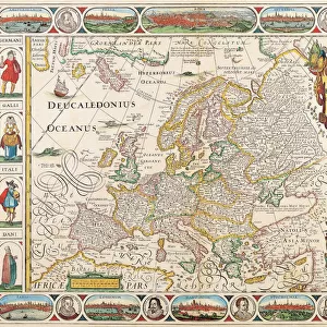
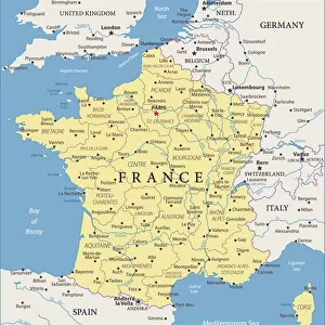
Map of Europe 1869

![]()
Wall Art and Photo Gifts from Fine Art Storehouse
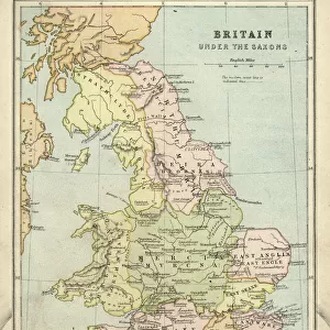
Map of Europe 1869
Cornells Grammars-School Geography - S.S. Cornell - New York D. Appleton and Company 1869
Unleash your creativity and transform your space into a visual masterpiece!
THEPALMER
Media ID 13668817
© Roberto A Sanchez
62990 Earth Globe Man Made Object Globe Navigational Equipment Portugal World Map Obsolete Retro Styled
FEATURES IN THESE COLLECTIONS
> Europe
> United Kingdom
> Maps
> Fine Art Storehouse
> The Magical World of Illustration
> Palmer Illustrated Collection
> Fine Art Storehouse
> Map
> Historical Maps
> Fine Art Storehouse
> Map
> Italian Maps
> Maps and Charts
> Early Maps
> Maps and Charts
> Italy
EDITORS COMMENTS
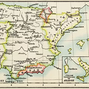
This print showcases a vintage map of Europe from the year 1869, taken from "Cornells Grammars-School Geography" by S. S. Cornell and published by D. Appleton and Company in New York. With its retro-styled design, this antique engraving takes us back to a time when cartography was an art form in itself. The intricate details of this engraved image transport us to a world where physical geography played a crucial role in understanding our planet. The borders of Spain, Portugal, Italy, Germany, France, and the United Kingdom are clearly defined on this old map that spans across Europe. As we gaze upon this piece of history, it reminds us of how much our world has changed over the years. This obsolete representation serves as a testament to the advancements made in geographical knowledge since then. The horizontal composition allows for easy viewing and appreciation of every minute detail presented on this globe navigational equipment turned illustration. It is evident that great care was taken during its creation to ensure accuracy and precision. "The Map of Europe 1869" is not just an ordinary man-made object; it represents an era when maps were cherished possessions used for exploration and education alike. Through THEPALMER's lens at Fine Art Storehouse, we can now admire this timeless piece that captures both the beauty and historical significance embedded within cartography's rich heritage.
MADE IN THE USA
Safe Shipping with 30 Day Money Back Guarantee
FREE PERSONALISATION*
We are proud to offer a range of customisation features including Personalised Captions, Color Filters and Picture Zoom Tools
SECURE PAYMENTS
We happily accept a wide range of payment options so you can pay for the things you need in the way that is most convenient for you
* Options may vary by product and licensing agreement. Zoomed Pictures can be adjusted in the Cart.