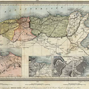
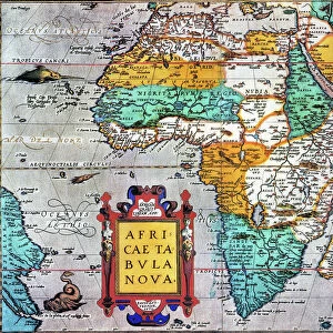
Home > Arts > Artists > O > Abraham Ortelius
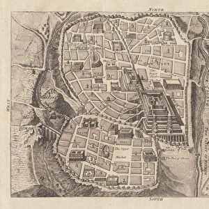
Historical geographical map of Palestine according to the Atlas of Abraham Ortelius

![]()
Wall Art and Photo Gifts from Fine Art Finder
Historical geographical map of Palestine according to the Atlas of Abraham Ortelius
GIA4772119 Historical geographical map of Palestine according to the Atlas of Abraham Ortelius, Amsterdam, 1588. by Ortelius, Abraham (1527-98) (after); Private Collection; (add.info.: Historical geographic map of Palestine from the Atlas of Abraham Ortelius, Amsterdam, 1588.); eGiancarlo Costa; Flemish, out of copyright
Media ID 22291026
© Giancarlo Costa / Bridgeman Images
16 16e 16eme Xvi Xvie Xvieme Siecle Carte Geographique Geographical Map Geographie Palestine Palestinian
FEATURES IN THESE COLLECTIONS
> Arts
> Artists
> O
> Abraham Ortelius
> Fine Art Finder
> Artists
> Abraham (after) Ortelius
> Fine Art Finder
> Artists
> Unknown Artist
> Maps and Charts
> Abraham Ortelius
> Maps and Charts
> Early Maps
EDITORS COMMENTS
This print showcases a historical geographical map of Palestine, as depicted in the Atlas of Abraham Ortelius. Created in Amsterdam in 1588, this remarkable piece offers a glimpse into the past and provides valuable insights into the region's geography during that time. The intricate details and precision of this map are truly awe-inspiring. Every contour, river, and mountain range is meticulously illustrated, offering viewers an opportunity to explore Palestine's rich topography from centuries ago. The craftsmanship displayed by Abraham Ortelius is evident through his attention to detail and dedication to accuracy. As we delve into this snapshot of history, it becomes apparent how much our understanding of geography has evolved over time. This map serves as a reminder that boundaries shift, names change, but the land remains constant. It allows us to trace the footsteps of ancient civilizations and gain a deeper appreciation for their connection with the land they inhabited. Giancarlo Costa's expert capture brings out every nuance and shade present on this aged artifact. Through his lens, we can appreciate not only its historical significance but also its artistic beauty. As we gaze upon this image today, let us reflect on how far we have come while honoring those who came before us - mapping out their world so diligently for future generations to marvel at.
MADE IN THE USA
Safe Shipping with 30 Day Money Back Guarantee
FREE PERSONALISATION*
We are proud to offer a range of customisation features including Personalised Captions, Color Filters and Picture Zoom Tools
SECURE PAYMENTS
We happily accept a wide range of payment options so you can pay for the things you need in the way that is most convenient for you
* Options may vary by product and licensing agreement. Zoomed Pictures can be adjusted in the Cart.