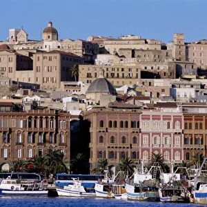
Home > Europe > Italy > Sardinia > Cagliari
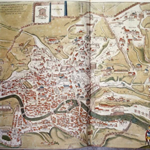
Plan of Cagliari (Calaris), Sardinia (Italy), Malta (Malta)
, Sardinia (Italy), Malta (Malta)")
![]()
Wall Art and Photo Gifts from Fine Art Finder
Plan of Cagliari (Calaris), Sardinia (Italy), Malta (Malta)
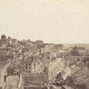
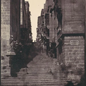
LRI4708517 Plan of Cagliari (Calaris), Sardinia (Italy), Malta (Malta), Rhodes (Rhodus) and Famagusta (Famaugusta), Cyprus (etching, 1572-1617) by Hogenberg, Franz (1540-c.1590); Private Collection; (add.info.: Plan of Cagliari (Calaris), Sardinia (Italy), Malta (Malta), Rhodes (Rhodus) and Famagusta (Famaugusta), Cyprus - Strong water extracted from Civitates Orbis Terrarum (Atlas of Cities of the World) by Georg Braun (1541-1622) and Franz Hogenberg (1540-1590), published from 1572 to 1617 - Cagliberg (1572 to 1617 Sardinia (Italy), Malta, Rhodes and Famagusta (Cyprus) - From " Civitates Orbis Terrarum" by G. Braun and F. Hogenberg, 1572-1617); Luisa Ricciarini; Netherlandish, out of copyright
Media ID 23718160
© Luisa Ricciarini / Bridgeman Images
Atlas Book Cagliari Chypre Geographical Map Malta Rhodes Sardinia Exterior View Grece
FEATURES IN THESE COLLECTIONS
> Arts
> Artists
> H
> Franz Hogenberg
> Asia
> Cyprus
> Related Images
> Europe
> Greece
> Related Images
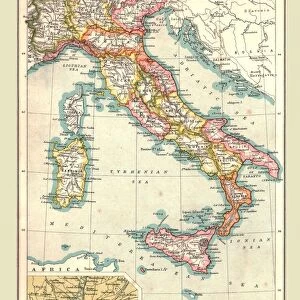
> Europe
> Italy
> Sardinia
> Cagliari
> Europe
> Italy
> Sardinia
> Related Images
> Fine Art Finder
> Artists
> Fabio Cipolla
> Fine Art Finder
> Artists
> Franz Hogenberg
EDITORS COMMENTS
This print showcases the intricate "Plan of Cagliari (Calaris), Sardinia (Italy), Malta (Malta), Rhodes (Rhodus) and Famagusta (Famaugusta), Cyprus". Created by the talented artist Franz Hogenberg in the late 16th century, this etching is a part of the renowned Civitates Orbis Terrarum atlas. The detailed map takes us on a journey through time, offering a glimpse into the ancient cities and landscapes of these Mediterranean regions. From Cagliari's winding streets to Malta's majestic fortifications, each location is meticulously depicted with precision and artistry. Hogenberg's collaboration with Georg Braun resulted in an extraordinary collection that spanned several decades. Published between 1572 and 1617, their work aimed to document cities from around the world. This particular piece highlights not only geographical accuracy but also provides insight into urban planning during that era. Luisa Ricciarini has skillfully captured this historical artifact through her lens, preserving its beauty for generations to come. The engraving comes alive as we explore every corner of this mesmerizing composition - a true testament to human ingenuity and artistic brilliance. As we admire this remarkable artwork, let us appreciate how it connects us to our past while inspiring curiosity about these enchanting destinations.
MADE IN THE USA
Safe Shipping with 30 Day Money Back Guarantee
FREE PERSONALISATION*
We are proud to offer a range of customisation features including Personalised Captions, Color Filters and Picture Zoom Tools
SECURE PAYMENTS
We happily accept a wide range of payment options so you can pay for the things you need in the way that is most convenient for you
* Options may vary by product and licensing agreement. Zoomed Pictures can be adjusted in the Cart.