Home > Maps and Charts > World
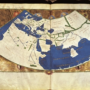
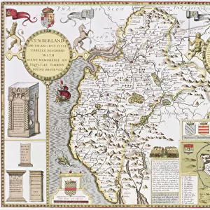
Map of the world, Atlantis in its Decadence, published by the Theosophical

![]()
Wall Art and Photo Gifts from Fine Art Finder
Map of the world, Atlantis in its Decadence, published by the Theosophical
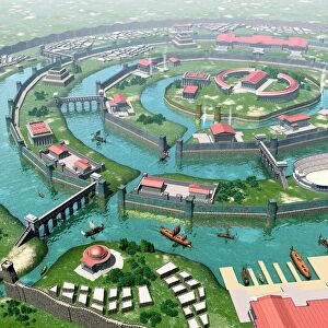
BAL54265 Map of the world, Atlantis in its Decadence, published by the Theosophical Publishing Company (litho) by English School; Private Collection; (add.info.: world after the catastrophe of 800, 000 years ago and up to the catastrophe of about 200, 000 years ago ; showing the legendary lost continent of Atlantis; ); English, out of copyright
Media ID 12918409
© www.bridgemanimages.com
FEATURES IN THESE COLLECTIONS
> Arts
> Artists
> Related Images
> Fine Art Finder
> Artists
> E
> English School English School
> Fine Art Finder
> Maps (celestial & Terrestrial)
> Maps and Charts
> World
EDITORS COMMENTS
This print showcases the "Map of the world, Atlantis in its Decadence" a remarkable creation published by the Theosophical Publishing Company. With intricate lithography and attention to detail, this English School masterpiece takes us on a journey through time. The map depicts a world devastated by two catastrophic events that occurred hundreds of thousands of years ago. From 800,000 years ago until approximately 200,000 years ago, our planet experienced immense turmoil and destruction. This visually stunning artwork provides an imaginative glimpse into this tumultuous period. Of particular interest is the representation of the legendary lost continent of Atlantis. Shrouded in mystery and myth, Atlantis has captivated human imagination for centuries. This map offers a unique interpretation of what this fabled land might have looked like during its decadent phase. Every corner of this print invites exploration as it reveals ancient civilizations and forgotten landscapes that once thrived before these cataclysmic events reshaped our world's geography forever. As we gaze upon this extraordinary piece from our private collection, we are reminded not only of humanity's fascination with lost civilizations but also how art can transport us to realms beyond our own reality. Let your imagination soar as you delve into the secrets hidden within this mesmerizing depiction of Earth's past.
MADE IN THE USA
Safe Shipping with 30 Day Money Back Guarantee
FREE PERSONALISATION*
We are proud to offer a range of customisation features including Personalised Captions, Color Filters and Picture Zoom Tools
SECURE PAYMENTS
We happily accept a wide range of payment options so you can pay for the things you need in the way that is most convenient for you
* Options may vary by product and licensing agreement. Zoomed Pictures can be adjusted in the Cart.